MERTON GREEN
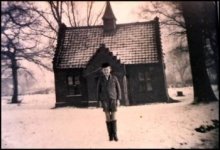
| The Old School ( below left ) that once stood on the
green was erected by Lord Walsingham in 1874 for 30
children; average attendance would have been 22. In 1883 School mistress
was
Miss Sarah Herring and 1892 was Mrs Kate Kirk. The young boy seen in the photo below is John Baldwin, at the time of this photo the School was closed. During 1942 it was used by the home guard, a few years later it was demolished. A small piece of the school entrance step can be seen today. |
|
|
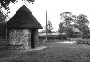
| The Bus shelter ( above right ) has a thatched roof
over flint and red brick walls, the shelter was given by
the villagers and friends of Merton to commemorate the
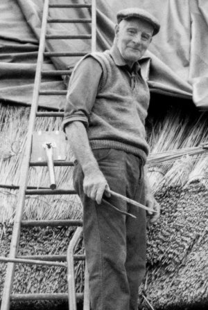
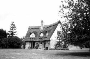
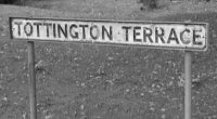
Silver Jubilee of 7th June 1977. The shelter has seating areas inside and out, and was built by a local builder, the roof was thatched by local Thatcher Alwyn Mindham. Outside seating was built by local man Glendy Sutton. With labouring help by local children and pensioners. Thatched cottage (below right) known as " Darkins Piece " built by Alwyn Mindham, the roof was thatched by himself and his father Albert Mindham, Also the local Thatcher for the Estate for many years, and can be seen here at the age of 88, working on Darkins peace. Although quite a modern build ( 1984 ) it is as all new properties should be , in parr with the older and original part of the village, and so holds the character in whole. If only others would follow this perfect example. Tottington Terrace, so called when people of Tottington village were forced from their homes in the early years of the second world war (1942) by the War Department and used by the M.O.D., Known as the Battle Area. The people of Tottington,and other close by village's were given other accommodation, some here at Merton Green. Original residents of Tottington were given assurances that when the war ended they would be allowed to return to there homes, This promise was never kept.... There is a excellent book that covers this and the history of Tottington;- "A Lost Village In Norfolk", by Hilda and Edmund Perry, isbn 0 90061656 3. Pictures below courtesy of Alwyn Mindham |
 |
 |
 |
| To the West of Merton Green just off the Peddars way,
where in a tiny marl pit rests a boulder which was swept to its present
position
by the ice in the last glacial period. It is said to be the
largest of its kind in Norfolk and possibly Britain...
The boulder also holds a history of
a mystical source, I have been told by many people
of there personal experience's, some memories handed down from there
fore fathers. Stories such as, when standing on the
stone one feels an ice cold feeling
. also a feeling of some kind of unexplainable spiritual presents. Its
not surprising as Merton is one of those special places of
interest which holds many unexplained events. It is said if this stone is removed all the waters will rise and
flood the village and beyond. The 7th Baron gathered together some men and attempted to move the stone
with ropes and horses and failed in their task. The Stone can be found via grid reference TL895991 or check out
the
MAP HERE Heading west from Merton Green one comes to a cross roads of tracks, Left is Home Farm you continue straight ahead west bound following Peddars Way, Go to the bottom of the long field to your left , at the bottom of the field on the left there is a small ditch, follow this some 20 yards, you are there. |
 |
CAPPS BUSH
Just a short distance from the Merton Stone is Capp's Bush, a place where the original Peddar's Way travelled through. This can be scene on some of the older maps dating back to 1794, which shows the possion of Capps Bush. Tales tell of a burial place following the suicide of a traveller or soldier, However it's not known if the name Capp would have been the persons name. It has been said that the Bush should never be removed, however until a few years ago the Bush still stood, but with modern farming it seems it had to go....
You may be
viewing this page with no menu, If this page does not
show a menu,
|